Sharing Features in iGIS
iGIS 8.3.0 lays the foundation for potentially revolutionary sharing and collaboration features. To see the full list of changes, please read our change log.
With iGIS 8.3.0, multiple users are now able to work on the same spatial layers separately and merge the differences. This guide explains how these sharing features work and their limitations.
To explain how sharing works, the example of three people working on the same data will be used.

Sandra goes south and finds a couple of buildings so she adds them to the map. She discovers that incompetent John had made another mistake. She edits the fourth record. Notice the way the IDs are generated. If Sandra had the same username as Phil, iGIS would think that the features were the same!

Sandra and Phil return from their expeditions. Phil wants to get the changes that Sandra made. She exports her data the same way she always does in iGIS and gives a copy of the zip file to Phil.
Phil imports Sandra’s zip file using iGIS. iGIS realises that the data being imported is in the sharing format and that it has the same name as data already on his device. It offers Phil the option to merge the new data with his existing data.
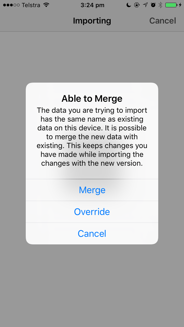
Phil decides to merge Sandra’s data onto his device. iGIS immediately imports every new item that Sandra added. New items will have unique IDs so it is very important that everyone using iGIS chooses a different username than the people they are sharing with. This username can be changed in Settings.
iGIS also keeps track of when the most recent edit was made. To decide which version of the same feature it has to keep, iGIS will always keep the most recent change. If a feature has no changes, iGIS will skip it.
Sandra’s version of John004 was more recently updated than Phil’s, so it replaces Phil’s copy. Phil’s deletion of John002 was more recent than Sandra’s copy, so it is kept.
If Sandra edited Phil’s deleted copy of John002 after he deleted it, it would have been merged in with his data and would be shown on the map again with Sandra’s edit.
After the merge, Phil’s data will look like it is below (with changes and deletions highlighted).

Phil now has a complete copy of all the data. He can give this to Sandra and John and they will get identical data by either overriding their copies or merging.
Note: this explanation simplifies some aspects of the sharing process, such as the length of the IDs.